Post by Admin on Jan 20, 2022 22:39:38 GMT -7
Southwest of Moab.
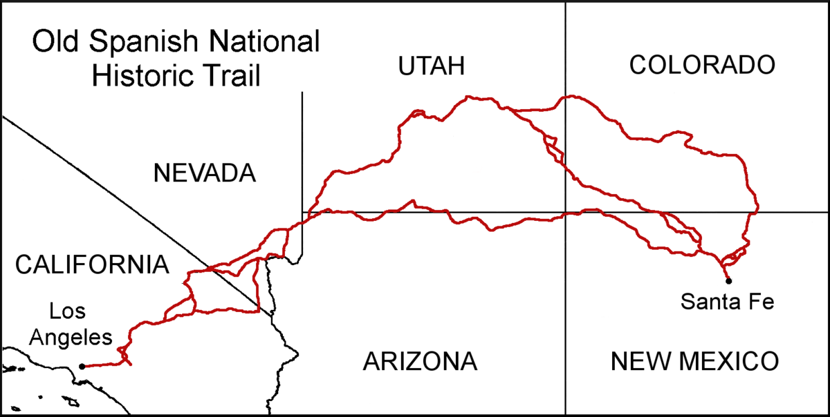
An early Spanish explorer discovered an easy path along "Pack Creek" that flows northwest through what they named "Spanish Valley," north northwestward into what is now Moab Valley toward its confluence with the Colorado River. There they were able to build a ferry and cross the Colorado River.
expeditionportal.com/forum/threads/moab-utah-jackson-hole.145413/
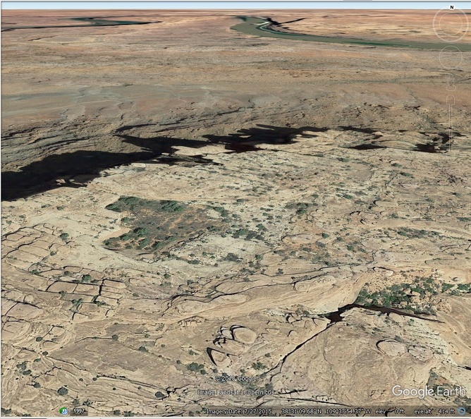
East of Jackson hole is a huge series of curious sandstone formations.
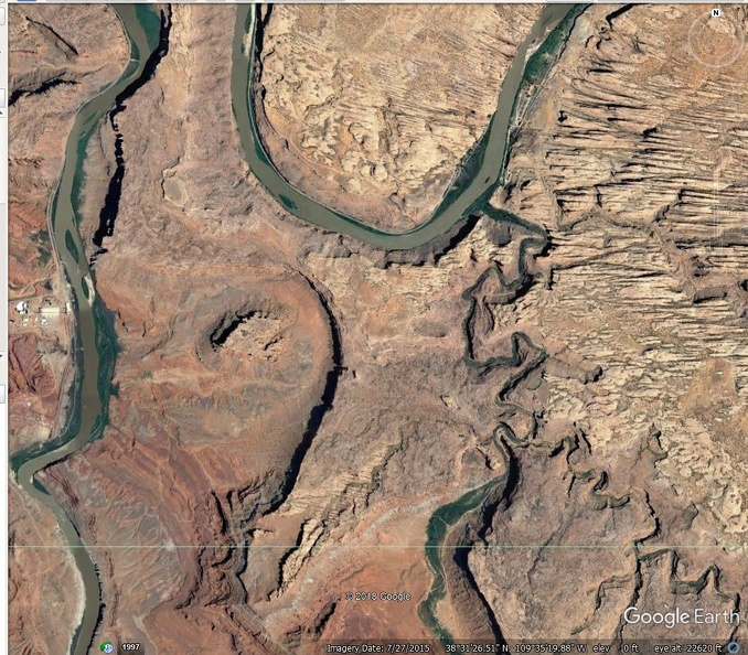
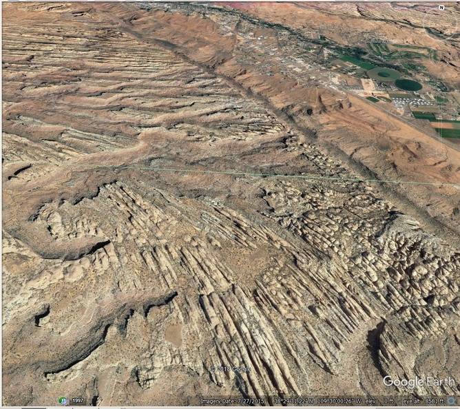
Do they preserve an ancient prevailing wind pattern?
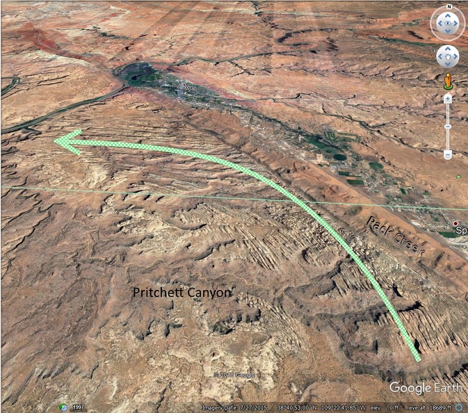

An early Spanish explorer discovered an easy path along "Pack Creek" that flows northwest through what they named "Spanish Valley," north northwestward into what is now Moab Valley toward its confluence with the Colorado River. There they were able to build a ferry and cross the Colorado River.
en.wikipedia.org/wiki/Old_Spanish_Trail_(trade_route)
The Main Route (also referred to as the Central Route or the Northern Route) of the Old Spanish Trail avoided territory of the Navajo, (who had returned to a state of hostilities after Armijo's trip), and the more difficult canyon country traversed by the Armijo Route around the Colorado River. First traveled in 1830 by a party led by William Wolfskill and George Yount, this route ran northwest from Santa Fe through southwestern Colorado, past the San Juan Mountains, Mancos, and Dove Creek, entering Utah near present-day Monticello. The trail then proceeded north through difficult terrain to Spanish Valley near today's Moab, Utah, where a ferry crossed the deep and wide Colorado River and then turned northwest to a ferry crossing on the similarly sized and dangerous Green River near present-day Green River, Utah. The route then passed through (or around) the San Rafael Swell, the northernmost reach of the Trail. Entering the Great Basin in Utah via Salina Creek Canyon, the trail turned southwest following the Sevier, Santa Clara, Virgin Rivers to the north bank of the Colorado River. There they could follow the Colorado River to Las Vegas Wash, then south through the Eldorado Valley and Piute Valley to join the Mojave Trail, west of the Mohave villages (below modern Laughlin) and followed the route between the springs along the Mojave Trail to Soda Lake and the Mojave River. Later caravans could alternatively follow the Armijo Route diverting southwestward from the Colorado at Las Vegas Wash, to Resting Springs and to the Mojave River where it joined the Wolfskill/Yount Route, following that river upward to and over the San Bernardino Mountains through Cajon Pass, Crowder Canyon and lower Cajon Canyon and across the coastal valleys to Mission San Gabriel and Los Angeles.
The Main Route (also referred to as the Central Route or the Northern Route) of the Old Spanish Trail avoided territory of the Navajo, (who had returned to a state of hostilities after Armijo's trip), and the more difficult canyon country traversed by the Armijo Route around the Colorado River. First traveled in 1830 by a party led by William Wolfskill and George Yount, this route ran northwest from Santa Fe through southwestern Colorado, past the San Juan Mountains, Mancos, and Dove Creek, entering Utah near present-day Monticello. The trail then proceeded north through difficult terrain to Spanish Valley near today's Moab, Utah, where a ferry crossed the deep and wide Colorado River and then turned northwest to a ferry crossing on the similarly sized and dangerous Green River near present-day Green River, Utah. The route then passed through (or around) the San Rafael Swell, the northernmost reach of the Trail. Entering the Great Basin in Utah via Salina Creek Canyon, the trail turned southwest following the Sevier, Santa Clara, Virgin Rivers to the north bank of the Colorado River. There they could follow the Colorado River to Las Vegas Wash, then south through the Eldorado Valley and Piute Valley to join the Mojave Trail, west of the Mohave villages (below modern Laughlin) and followed the route between the springs along the Mojave Trail to Soda Lake and the Mojave River. Later caravans could alternatively follow the Armijo Route diverting southwestward from the Colorado at Las Vegas Wash, to Resting Springs and to the Mojave River where it joined the Wolfskill/Yount Route, following that river upward to and over the San Bernardino Mountains through Cajon Pass, Crowder Canyon and lower Cajon Canyon and across the coastal valleys to Mission San Gabriel and Los Angeles.
expeditionportal.com/forum/threads/moab-utah-jackson-hole.145413/
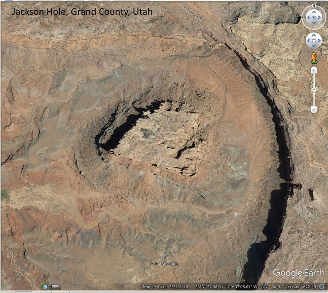
The Moab area has its own "Jackson Hole" named after a John Jackson, an early pioneer cattleman. Actually it is a rincon of the Colorado River. And its most important feature is rock redness. At least partially.
Lets start im Moab. Kane Creek Blvd on the south bank of the Colorado River, later the name changes to Kane Springs Road. Pavement ends earlier and the road up to Hurrah Pass is no longer a graveled one. Simply dirt and some minor rocks.
After driving over the summit the trail is named Lockhart Basin Rd and we will use it to travel down the western slopes of Hurrah Pass. After a little less than 3 miles from the summit the trail crosses a shallow wash (12S 0617875, 4258725) The main trail goes straight, the right one into the wash leads to Jackson Hole.


East of Jackson hole is a huge series of curious sandstone formations.


Do they preserve an ancient prevailing wind pattern?

