|
|
Post by Admin on May 15, 2022 6:56:16 GMT -7
|
|
|
|
Post by Admin on May 15, 2022 12:24:39 GMT -7
|
|
|
|
Post by Admin on May 16, 2022 10:24:37 GMT -7
I'm trying to get my mind around your pet wood. How old is it? You said it was Mesozoic? What was going on back then that would bury huge amounts of trees? 6 months between dying and being buried would start the wood checkering before petrifying.  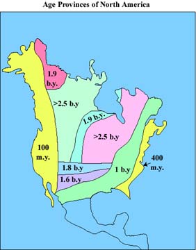 Eocene? - Perhaps Paleocene? waves from Chexulube? Tallahatta really got me - Metamorphic nonmetamorphic? I can see wood petrifying in the Mesozoic then being pressured in the Eocene to create the mica flakes. What created that huge "WAVE" in the middle of the eastern USA? 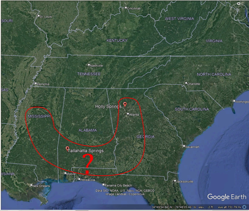
Oceanic sands still cover most of the coastal plain below the Fall Line. And it is underlain by limestone proving persistent oceans. Most of the land below the Fall Line is flat and sloping toward the Gulf of Mexico or the Atlantic Ocean. Except Alabama, it's coastal plain is hilly and the Mesozoic level shoreline is much more complex due to the hilly topography, this is where I am spending time. There are many smaller geologic features and deposits in this complex topographic area. I have no idea of when meteor impacts did their damages other than the dinosaur killer during the Mesozoic level ocean. It sure may have pushed these Alabama wood deposits up against the Fall Line bluffs. That makes perfect sense. But it appears the wood was already petrified when deposited at my collecting area(it is highly fractured, mixed every which way and down to a 50 foot depth. Either hellacious wave action or an impact deposited this wood. Be aware I am collecting 40 miles south of the 6 mile crater caused by the Wetumpka meteor. It too is in the Tallapoosa River drainage, it even rerouted the Tallapoosa River. The drainage I am collecting in is far to the east of the Tallapoosa River but does flow west into the Tallapoosa. The deposit is almost inside the SE corner of the 'total devastation zone' of the Wetumpka impact. But the wood deposit is completely devoid of non-quartzite quartz from the Wetumpka area. The deposit is 25 miles east of letters KM in the devastation circle.  Ah, the Fall Line, the ancient ocean shoreline of the dinosaurs. This material appears to be just another silicified sedimentary deposit. It just happened to favorable conditions for wood silicification. The wood appears uprooted by a flood and being that it initially floats wave action pushed it deep into the the coves along the 300 miles of the Alabama fall shore line. Every cove along the Alabama fall line contains petrified wood. Albeit much is poorly petrified. However this section of the fall line is particularly rich in silica judging from the mass silicified sandstone. Well, that was my theory used to find the deposit... "The Tallahatta Formation consists of several types of siliciclastic sedimentary rocks. The dominant lithology is micaceous sandy claystone. It is thick-bedded, massive, and contains abundant trace fossils and burrows. A study by Schroeder and Harris (2004) in Mississippi determined that the claystone contained significant amounts of opal-CT (essentially non-crystalline quartz) and the zeolite mineral clinoptilolite. The presence of both of these minerals are significant as they are thought to be alteration productions derived from volcanic ash. Indeed, Schroeder and Harris (2004) imply that much of the fine sediment in the Tallahatta Formation in Mississippi was derived from a volcanic source. They also suggested that opal-rich claystone in Alabama might have been derived from more biogenic sources as they contain fewer zeolite minerals and, as observed in this study, more marine indicators (e.g., burrows). Other researchers (e.g., Counts and Savrda, 2004) have suggested that diatoms might have been the source of much of this biogenic silica." My goldmine collecting zone for fossils, cherts and artifacts: 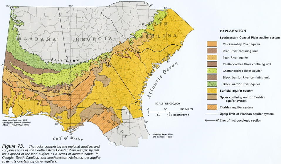 |
|
|
|
Post by Admin on May 17, 2022 18:06:24 GMT -7
|
|
|
|
Post by Admin on May 22, 2022 9:32:21 GMT -7
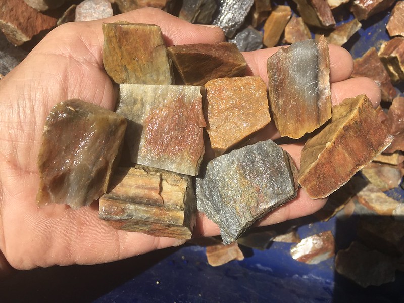
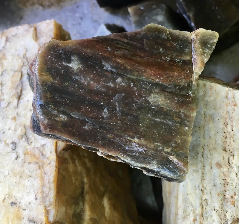
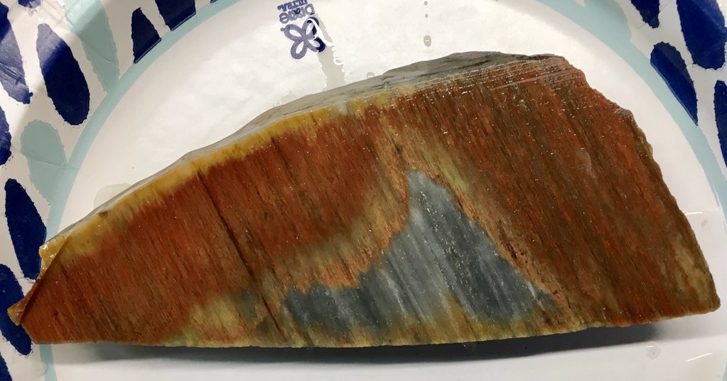
Are these layers too flat and straight to be wood? Even if not wood they are still winners!  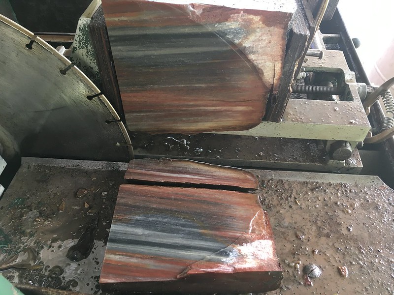 The grey sections often appear to be layered sand deposits Dave. This material fossilized in sand, see Tallahatta Sandstone. Here is a great example, looks like(layered ?) sand on left, and wood or vascular plant tissue in red on right. 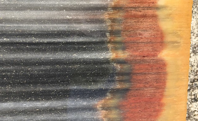 Sharp observations Dave. Most of this material has no annual rings suggesting it is a vascular plant and not wood. I found 12 inch diameter fossilized horsetail 150 miles northwest of here at same ancient shore elevation. Horsetail is certainly a vascular plant ! This appears to be the same wood or plant from same location with a different silicification, note the banding is all the same thickness suggesting a vascular plant. Annual rings vary in thickness, vascular structure usually stays the same thickness throughout: 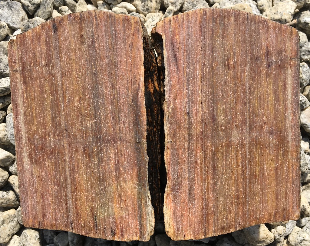 closer in, note exactly equal spacing of vertical bands - got to be vascular and not wood. Giant wetland rush, solid bamboo, i.e. a hard, straight growing vascular plant. NO LIMB KNOTS = vascular plant  this also from same site 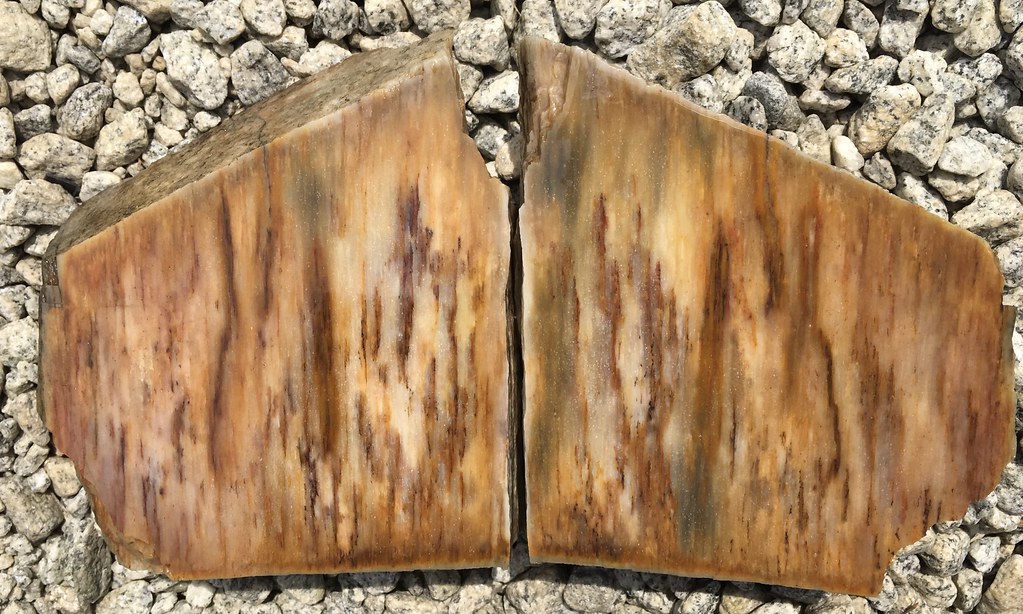 closer in  I will start sawing other variations of silicified samples like the above two samples. The plant appears to be a monoculture of one species. However silicifications vary tremendously and repeatedly based on moisture levels of soil. This deposit is in various soils that vary from dry to permanently inundated and likely in silicification mode this moment. Cool site, may unlock some silicification mysteries, key to understanding our fossil record and rate of silicification... |
|
|
|
Post by Admin on May 22, 2022 9:38:53 GMT -7
Closely related 1dave - quick brief on Tallahatta Sandstone: www.geoarchaeology.southalabama.edu/tal-sand_sedimentology.htmlMuch of Tallahatta sandstone is made of sharper sub-angular sand and not rounded beach sand. Probably from the largest sand deposit in the world eroding from high speed cavitation induced erosion from the receding waters of the central continental ocean. Tallahatta sandstone deposit layer is no slouch at 40m/170 feet thick. That is a lot of silicified sandstone and a lot of liquid silica. This intercontinental sea:  |
|
|
|
Post by Admin on May 22, 2022 9:55:15 GMT -7
This belongs here James! Ah, this inner continental sea as it relates to the(it's shoreline) Fall Line, the largest sand deposit in the world along the Gulf coast, and a massive oil deposit under the massive sand deposit. When this sea receded at great speeds toward the Gulf(just as the Mississippi River flows south into the Gulf) due to a rapid heating event it washed all living organisms and high speed flow induced cavitation sand production across central North America into the Gulf. And deposited massive amounts of volcanic ash forming thick caliche deposits in south Texas via the Rio Grande drainage along with billions of fine cobblized agates/woods/jaspers from Mexican, Colorado, New Mexican and Texan lava fields. This inner continental ocean drained in a southerly direction rapidly: That is why there is the world's largest high speed cavitation induced sand deposit in the world in the Gulf. That is why there is massive oil deposits due to massive depositions of living organisms under the sand along the Gulf Coast. That is why there is massive chert and fossil deposits at and below the Fall Line. That is why there is billions of rounded agates/woods/jaspers with known origins from the upstream states along the Rio drainage in south Texas. That is why there is massive caliche deposits from the lava fields of upstream states along the Rio drainage in south Texas. That is why there is large cobble hills along the Rio Grande in south Texas left by cobble deposits at the inside turns of the flood water drainage. It was a giant version of the Missoula flood(s). What caused it ? Ice dam(s) ? Cosmic impact(s) causing great worldwide heating ? The cause may be unknown or complex but the evidence of this catastrophic receding water event is overwhelming. Down south anyway. The high flows eroded the north, the deposits ended up in the south. There is two conclusions to a rapid drainage, erosion of higher elevations and sedimentation deposition on lower elevations. Which one is easier to analyze, the erosion or the deposition ? IMO it is the deposition.   |
|
|
|
Post by Admin on May 22, 2022 9:56:04 GMT -7
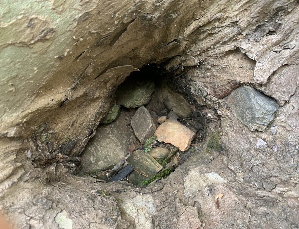
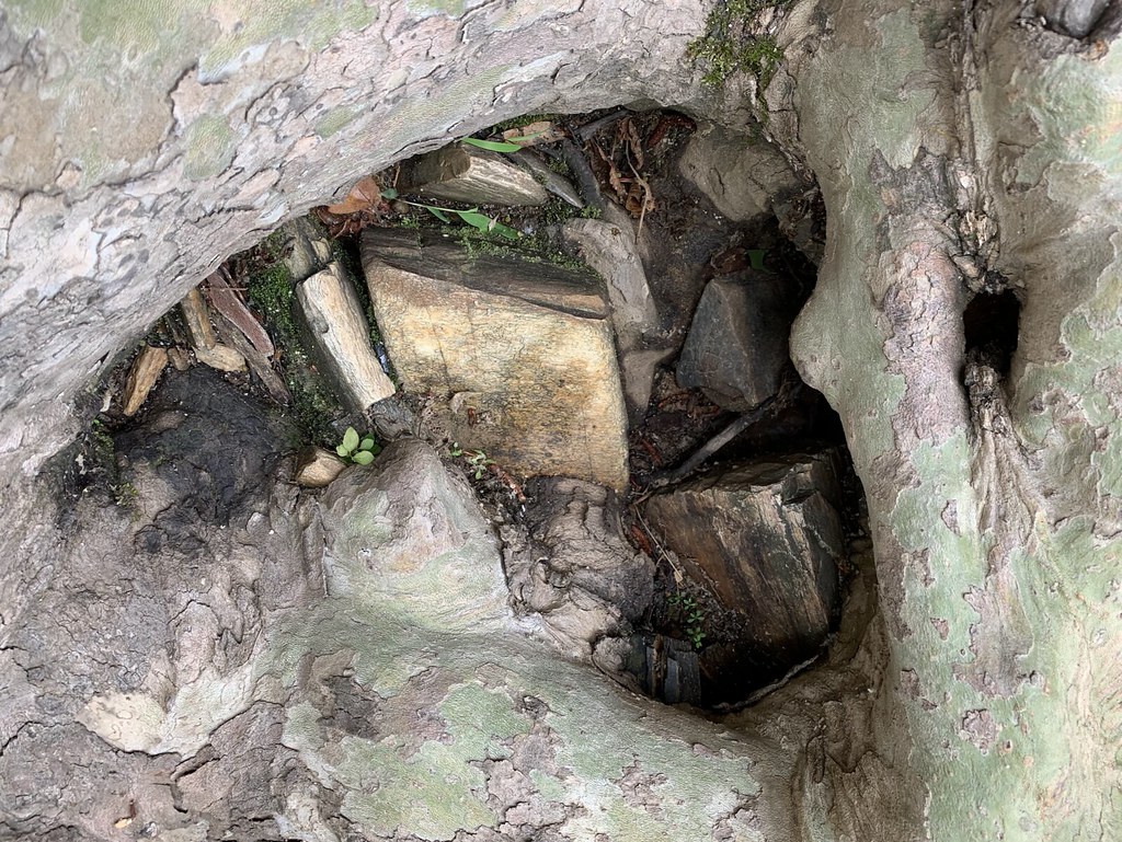
Advanced pecky fungus thrives on cypress logs buried deep in peat bogs and can turn a single log into 100's of small pieces. Trees are not always divided into small pieces by violent forces, fungus and rot does a fine job.  Such pockets in sunken logs become impacted with sand whe under water. Do not attempt to turn a bowl out of a sunken log if you respect your cutting chisels. |
|
|
|
Post by Admin on May 25, 2022 11:47:45 GMT -7
Q: How small are the pieces it shatters into if dropped on a big rock? Smaller than 2"X2" excellent tumble material for selling.  That is the way it is Dave. But, too much work collecting tumble rock for this aging body. Finding that the finest silicification is by far found in the short log segments less than 3 inches long. Obviously the silica was transported easier thru the vascular capillary terminations at the log ends. This issue limits the tumble-able wood to about 10 to 20% since most of the pieces are much longer than shorter. However some longer logs have near parallel permeable fractures running across the grain their entire length which allowed long log sections to silicify beautifully throughout. Silicified coral has capillaries in it's tubes also, short sections of coral are almost always more colorful. Example - well silicified and colorful short log sections from 1/2" to 2" long in grain direction. All stacked with grain running up and down. Even after petrification the wood still(hammer) splits best with the grain like splitting firewood. 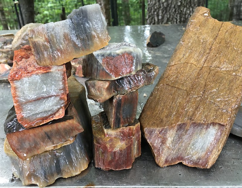 |
|
|
|
Post by Admin on May 25, 2022 11:54:13 GMT -7
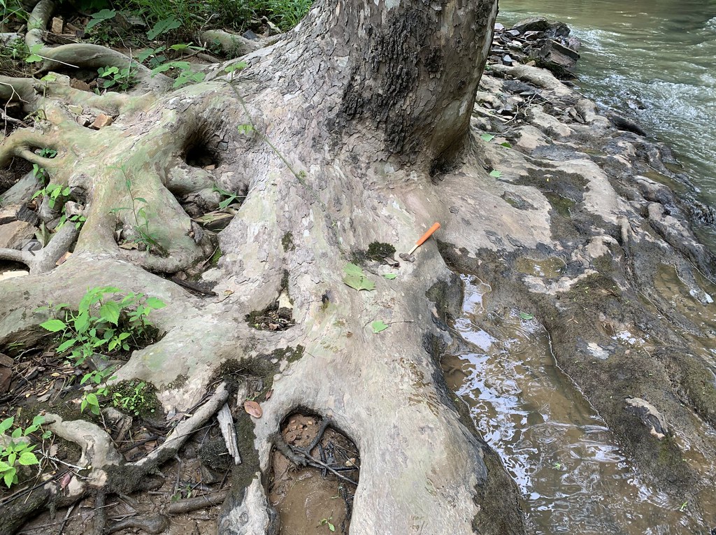
Unlike coral, wood floats and rots quickly. Meaning the wood has to first be uprooted, then transported, then deposited, then covered up to petrify/silicify/fossilize. All in a relatively short time frame of a year or two so as to beat the 'rot timeclock'. No doubt this wood was transported, heavily mixed, and deeply piled by deposition and covered with soil by deposition in the process. It is all located at steep sections of coves of an ancient ocean's shoreline(for over 300 miles of shoreline in this case). It is not located on flat areas, telling that oxygen exposure would have likely rotted it quickly, and/or it floated past flat areas. Wood does not last long in aerobic or anaerobic conditions unless conditions are unusually favorable(either frozen or in a high acid peat bog). Wood covered up in a peat bog almost always has fungus damage that would be visible in the petrifications. This suggests that petrification/silicification/fossilization is a fairly fast and WARM process. The much shorter creation hypothesis has always made sense to me from a depositional standpoint. I still can't find a single mineralized human bone but can find 1000's of mineralized mammal bones in streams and rivers in Florida. Mineralized mammal bones have been sought after for decades and not a single human bone in millions of mammal bones collected ? They found Paleo spearheads in mammoth remains, humans roamed with the mammoths. Certainly some humans died in those creeks and rivers...William Bartram accurately reported biological data to England as a contractor in the 1700's and he reported alligators over 25 feet long. Alligators are known to be long lived and can grow to great lengths. In recent centuries man has killed the big ones off(easy to do). None over 16 feet have been killed or seen in the past 100 years. It is likely that such large alligators had to have killed humans including the dense population of cottonmouth vipers, sabre tooth lions, leopards and other early carnivorous mammals. |
|
|
|
Post by Admin on May 25, 2022 11:57:11 GMT -7
|
|
|
|
Post by Admin on May 25, 2022 12:00:17 GMT -7
So pet wood burrows almost like termites! Which came first the pet wood or the tree? That is a poser. 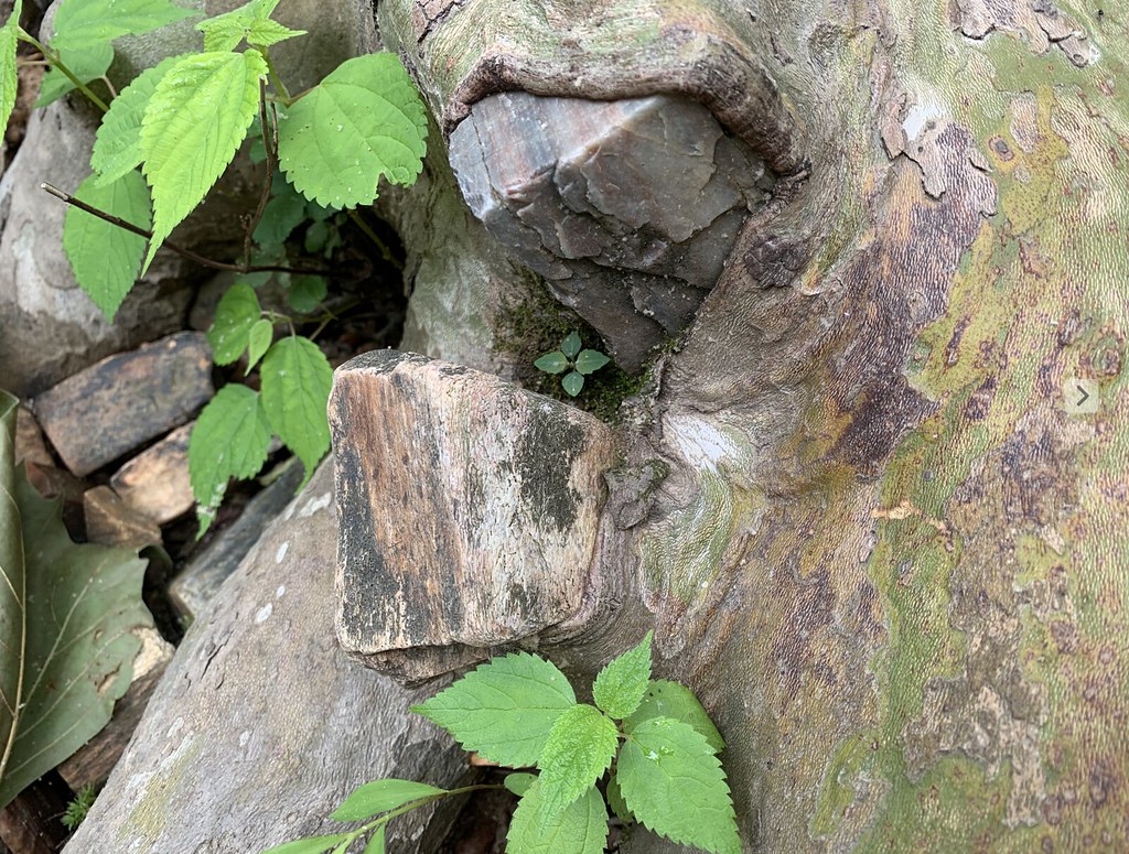 |
|
|
|
Post by Admin on May 30, 2022 13:46:55 GMT -7
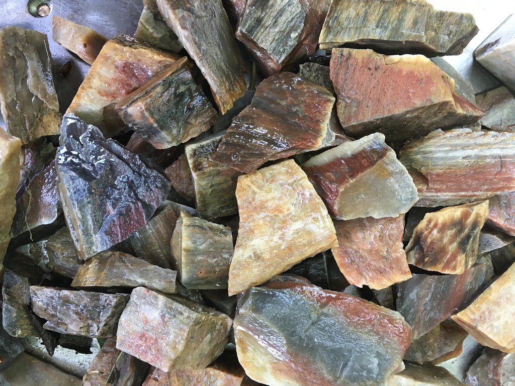
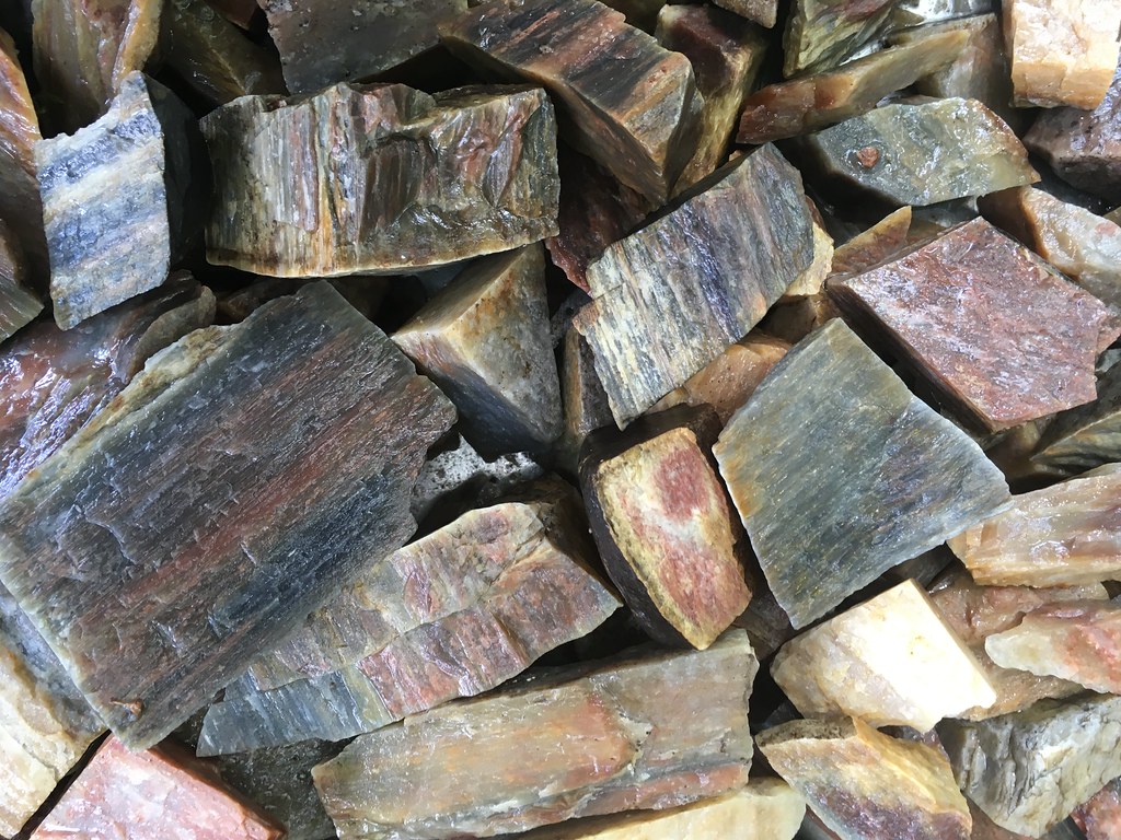
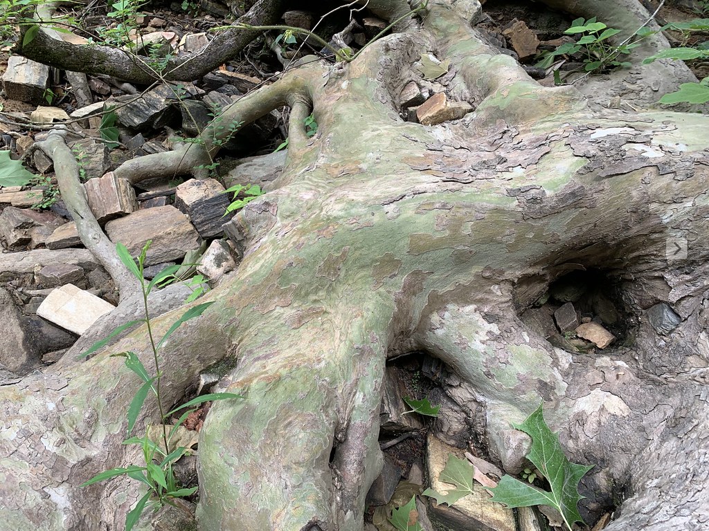
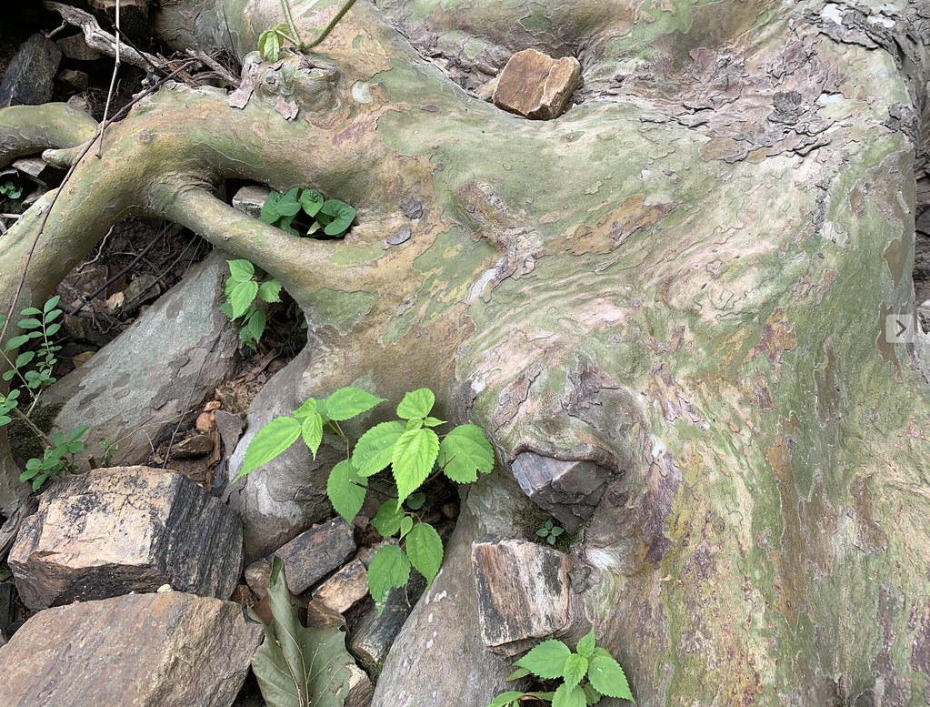
The focus of yesterday's trip was all about finding better lapidary specimens and better biological evidence. Better lapidary specimens became a success when looking at 'Clean' mass deposits rolling out of the creek banks. These specimens have no creek stains, the external colors helped a great deal in finding better colors and patterns. Creek stained wood: 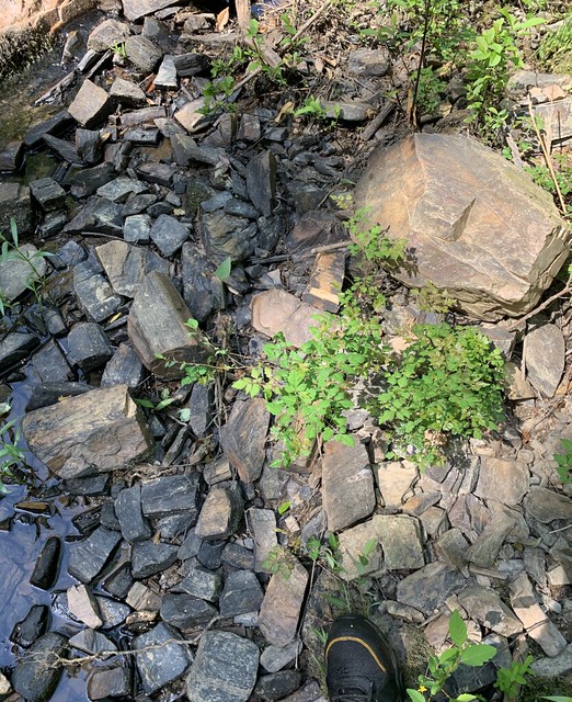 And pet wood that is falling into the creek that has yet to be stained:  Nice variety for lapidary fun: 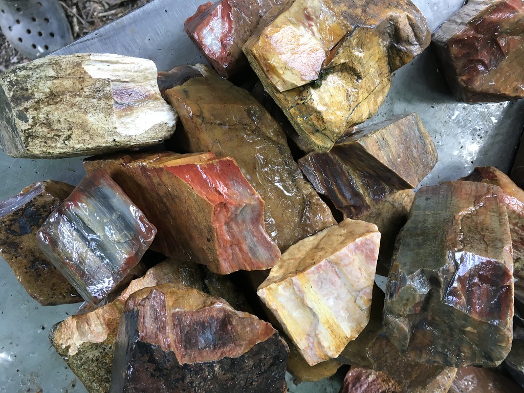 For the saw: 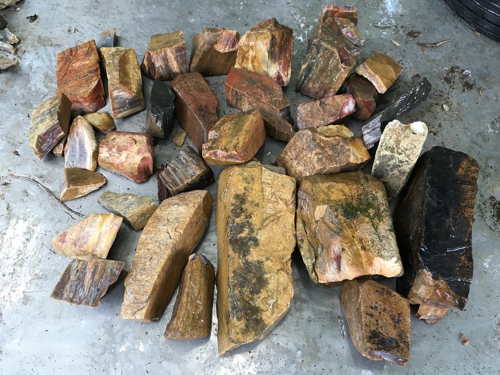 For the tumbler: 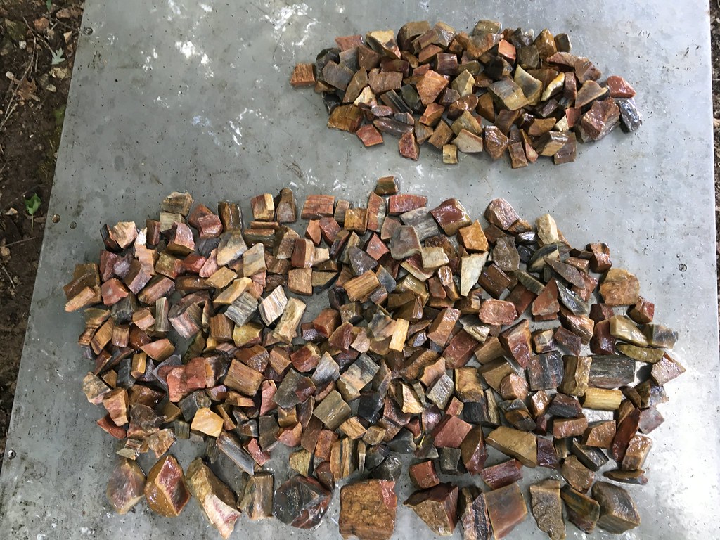 Some biological discoveries(what is this fossil ?): radial growth rings ?: 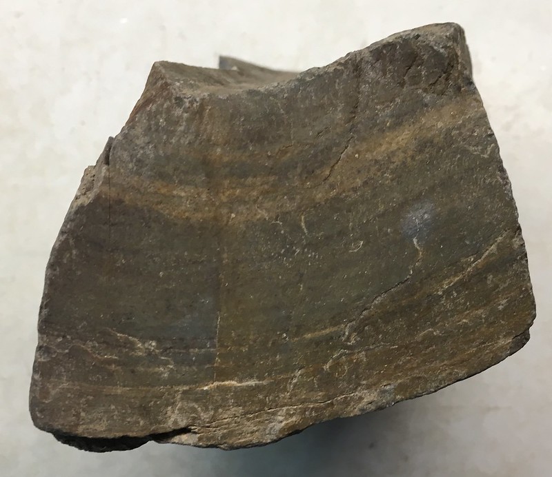 and it's side view:  This one appears to have a thick bark layer at bottom:  It also has faint rings with 'bark' to left: 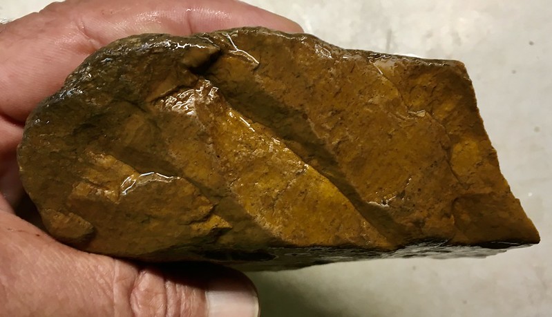 and it is well silicified: 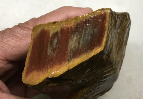 |
|
|
|
Post by Admin on Jun 3, 2022 9:33:53 GMT -7
Today's mission is using a backpack and electric scooter to haul some bigger chunks in. And scoping more distant samples. Will spend some trailblazing by cutting vines and saw briars to avoid 2 wheel clothesline catastrophes. 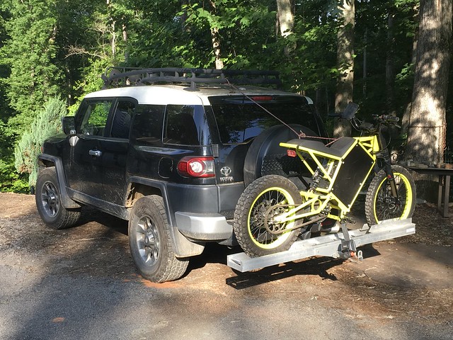 |
|
|
|
Post by Admin on Jun 3, 2022 9:35:15 GMT -7
Yesterday was a fascinating recon trip. The electric scooter was used to explore the petrified wood deposit boundaries on a 200 acre timber/hunting property with soil roads and a large powerline easement running thru the middle of the property. This time massive whole logs were located all resting **parallel to each other on a hillside at a fixed elevation as if a wind from the west(our present day prevailing wind is from the west !) had likely plied them there. Exactly the same way logs blow onto modern shorelines in parallel stacks. They were all resting at the shoreline elevation of the ancient Fall Line ocean. This petrified wood rich 'shoreline' has now been mapped out to 3000 feet of the ancient shoreline all exactly at the same elevation. This is a huge deposit. About the only way it could have petrified on that hillside is if volcanic ash from the central US had washed in on top of it and has since eroded away. An Alabama geologist reports that much of south Alabama was covered with a layer of volcanic ash. The nice colors of the petrifications relate to the minerals in volcanic ash. Upper left photo is a Native man's ~10,000 sq ft chipping zone covering a flat ridge with a great view and easy lead trail to creek. The largest waterfall was at the ridge termination. Come low water a bet will be taken that tool type artifacts will be common in the creek at that location.  Middle top photo of powerline easement - The wood was piled up on the distant plateau and it's slope. Not a stitch of it on the closer stretch. That distance slope is the elevation of the Fall Line ocean and likely receives prevailing wind head on(if prevailing wind is the same then as it is now). Looks like wave action piled the trees. Then covered with volcanic ash which has since eroded away. Some of the logs were 8 feet in diameter. 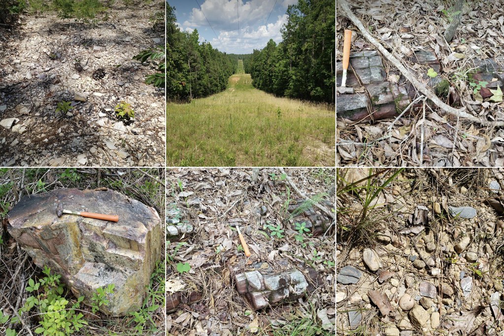 rich coloring suggests high minerals and metal salts on this big log 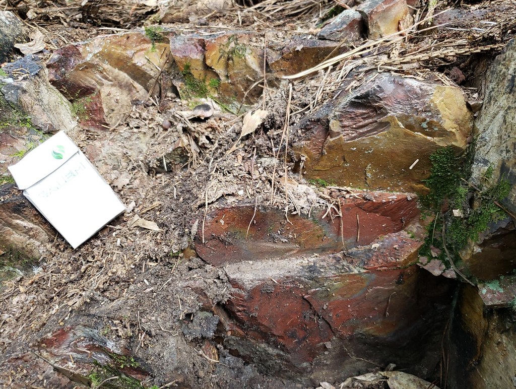 |
|